The Feb. 01, 2021 adoption of the 2015 edition of the National Building Code introduced a requirement for much of the region (St. Stephen, Saint Andrews, Rollingdam to Deer Island) to be built to earthquake-resistant standards.
We've written a detailed post in our knowledge base about this.
Unsure if the property you want to build at is in the zone requiring more robust construction?
Here's the heavy language: The Code requires greater construction if the spectral acceleration from an earthquake exceeds 0.7g (70 per cent the pull of gravity) at two tenths of a second after an earthquake. (Whewf.)
But it's simpler than it looks to find out whether that affects you - and all you need are two web pages.
The first is good old Google Maps. Crack that open - we'll wait.
The other is this one from the Earthquake Centre at the National Resource Council. As you will see, it wants latitude and longitude to calculate the earthquake activity in your area.
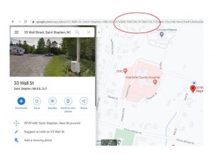
Enter your address in Google Maps. It will show you the latitude and longitude in the URL. In this example, we've used our office location - 33 Wall Street in St. Stephen.

Note in the URL bar where it has the latitude and longitude?

Use these numbers in the Earthquake Centre web-page. (Hint: you can cut and paste by highlighting the text you want in the URL, and hitting <ctrl><c> - or for you apple folks, <squiggle><c> to copy.) Make sure to include the "-" preceding the second figure!
 Hit the "submit" button. Then scroll down.
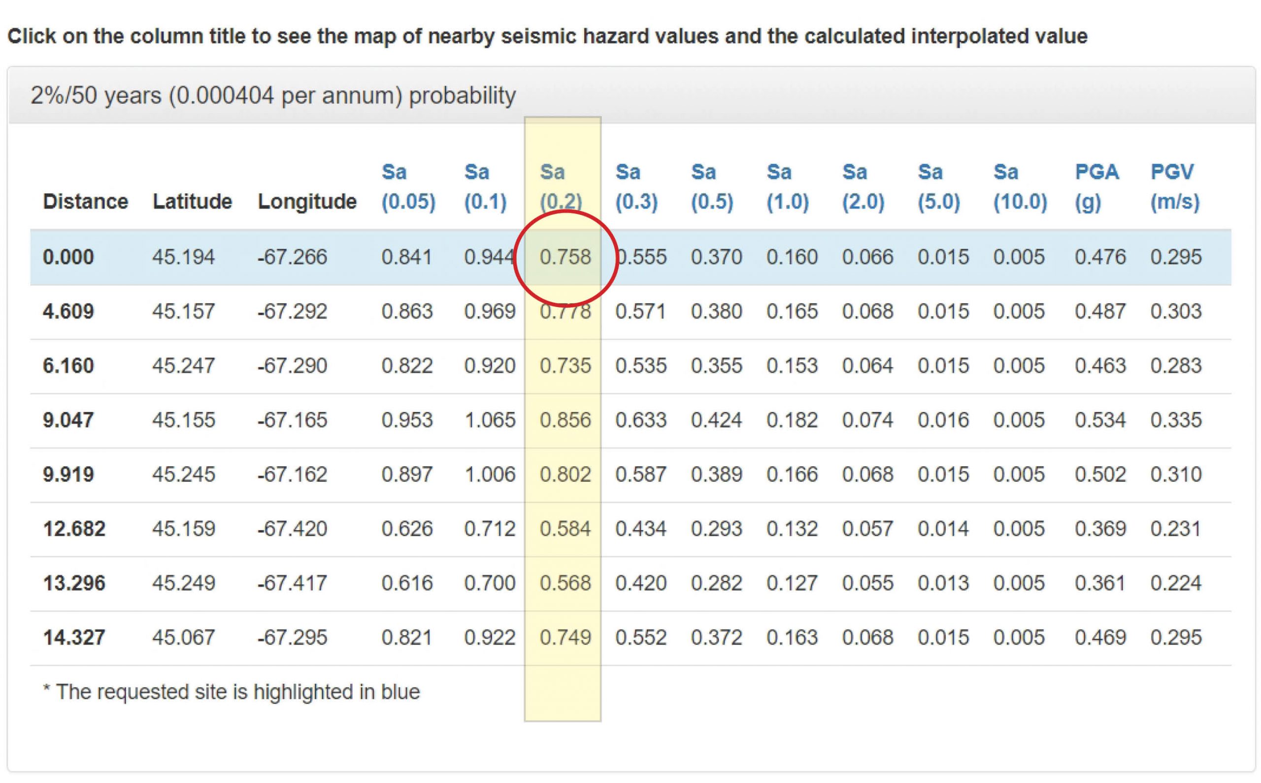
The critical information will be on the third column and first row.

This shows that the Sa (0.2) for our office is .758.
In other words, if we wanted to build something new, on this site, it would have to meet earthquake standards.
